Aerodist field party leaders during 1967 were Syd Kirkby and Con Veenstra. … On 26 August 1967, the centre party moved from Daly Waters to Elliot. After operating from Elliot for about two weeks the centre party returned to Daly Waters on 8 September 1967.NM/G/201 Station Summary: 'Station situated adjacent to Dept. of Interior bench mark No. DD 11. Aircraft Access: Wheel tracks of traverse DD, the swamp 4 miles to the North East and heavy scrub belts bearing 280° – 100° to west and S.W. of station clearly visible.
https://www.xnatmap.org/adnm/ops/prog/aaerod/adist6374/TheAerodistYears_Website.html#ch09toc_1
While the centre party was operating from Hooker Creek in 1968, Nat Mapper Murray Porteous drove across country from near Tennant Creek to Hooker Creek. This journey was to establish several dumps of helicopter fuel (in 44-gallon drums) in the featureless scrub of the Tanami Desert. Murray was driving Bedford ZSU 262 with a new field assistant, a French national Bernard Morell. They travelled along the DE level traverse established in 1964 by the Department of Interior. The traverse ran from the Warrego mine generally westward for about 250 km until it terminated at the Tanami to Hooker Creek track to the south of Wilson Creek, roughly 140 km south of Hooker Creek. The route along the traverse was marked only by the faint wheel tracks of the 1964 survey vehicles and a concrete bench mark about every 8 km. http://www.xnatmap.org/adnm/ops/prog/aaerod/adist6374/TheAerodistYears_Website.htmlIn 1968 National Mapping completed Aerodist Block Adjustment ADS BA13, and carried out ADS BA17 (McMaster 1980:23, in Annex D).
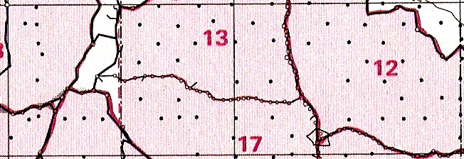
Measuring in Block 17 had commenced in 1968 and was substantially completed during 1970 but a few further lines were measured in 1971. Eventually a total of 22 stations were coordinated in Block 17.
For measurements in Block 17, the centre party was based at Alice Springs, Tennant Creek, and Willowra homestead. The Willowra pastoral lease covered an area of about 5,400 square kilometres along the Lander River bordering on the Tanami Desert about 330 kilometres north-west of Alice Springs. It was also home to a number of Warlpiri Aboriginal people who have since been granted freehold title to their land. Willowra is now known as the Wirliyajarrayi community. (McLean 2015)
Helicopter support was provided for measuring operations in Blocks 17, 22 and 31 during 1970. For this purpose a Hughes 500 369HS helicopter (VH-BLO) was chartered from Jayrow Helicopters Pty Ltd based at Melbourne’s Moorabbin airport. Later in the field season another Jayrow Hughes 500 helicopter (VH-BLN) replaced VH-BLO. Helicopter pilots were Vic Barkell, Peter Clemence (Jayrow chief pilot), Cliff Dohle and Lloyd Knight. The helicopter engineers included Peter Smart (Jayrow chief engineer), Dave King, Terry Gadsen and Jim Marsh. Helicopter VH-BLO is shown on task in the Simpson Desert during 1970 in Image 24 below.
Norm Hawker ran the 1970 field season helicopter support camps. Helicopter supported operations were conducted into the Simpson Desert in Block 22 from bases at Birdsville, a fly camp west of Glengyle homestead, Bedourie, Boulia, survey control station NM/B/293 about 100 kilometres west of Boulia, Tobermory homestead, survey control station NM/G/265 about 45 kilometres south-east of Tarlton Downs homestead, survey control station NM/G/270 about 15 kilometres south-west of new Jervois homestead, and at Andado homestead.
The Aerodist measuring work was then conducted over central and southern parts of the Northern Territory in Blocks 17 and 31 from helicopter bases at Alice Springs, Aileron, a fly camp at The Granites, Tennant Creek, a fly camp on the DE level traverse west of Tennant Creek, Willowra homestead, Yuendumu, Ayers Rock and Docker River. (McLean 2015)
©
2021
David
Nash
Created 16 May 2021
Modified 26 July 2021
URL http://www.anu.edu.au/linguistics/nash/kt/1968-71-Natmap.html